Transfert vers site distant ?

Une question, un bug ?
Répondre
clodmu
Membre
Messages : 39
Inscription : mer. juin 09, 2010 3:55 pm
Localisation : Île Maurice
Contact :

Transfert vers site distant ?

Message par clodmu »

Bonjour,

Pas bien compris comment effectuer les "réglages" d'envois, voici ce que j'ai mis :

Image

et voici la réponse en cliquant sur Démarrer le transfert FTP

Image

Un peu complexe ce système de transfert en regard des logiciels FTP de base ! Dommage car il me semble que beaucoup abandonne GW à cause de cela.
Station Vantage Pro 2
Site en reconstruction
Avatar de l’utilisateur
ardigier
Membre
Messages : 2260
Inscription : mar. mars 23, 2010 6:05 pm
Localisation : Le Thor 84250
Contact :

Re: Transfert vers site distant ?

Message par ardigier »

tu veux envoyer des données, des répertoires ou des graphiques ?
parceque ta capture ressemble à un mélange de tout ça.
pour des graphiques voila a quoi ça doit ressembler.
capture ftp.jpg
WMR200 - XNet meteo 2011-10-14a- graphweather V 3.0.35- Win10 x64
webcam installée orientation NE
http://le-thor-meteo.com/index.php
clodmu
Membre
Messages : 39
Inscription : mer. juin 09, 2010 3:55 pm
Localisation : Île Maurice
Contact :

Re: Transfert vers site distant ?

Message par clodmu »

Je souhaiterai afficher les graphiques mais trop complexes à déchiffrer par la majorité du publique donc je voudrai ajouter une feuille de gauges, plus simple à lire. Dans ce cas il faut bien ajouter aussi les données, non ? Ou ce n'est qu'une image genre copie d'écran ?
Station Vantage Pro 2
Site en reconstruction
Avatar de l’utilisateur
ardigier
Membre
Messages : 2260
Inscription : mar. mars 23, 2010 6:05 pm
Localisation : Le Thor 84250
Contact :

Re: Transfert vers site distant ?

Message par ardigier »

une gauge c'est un graphique donc a traiter comme tel
va voir mon site, ou l'un des graphique est sous forme de gauge
WMR200 - XNet meteo 2011-10-14a- graphweather V 3.0.35- Win10 x64
webcam installée orientation NE
http://le-thor-meteo.com/index.php
Avatar de l’utilisateur
jturlier
Membre
Messages : 3149
Inscription : mar. août 22, 2006 8:38 am
Localisation : 34410 Sérignan - Languedoc
Contact :

Re: Transfert vers site distant ?

Message par jturlier »

clodmu a écrit :Je souhaiterai afficher les graphiques mais trop complexes à déchiffrer par la majorité du publique donc je voudrai ajouter une feuille de gauges, plus simple à lire. Dans ce cas il faut bien ajouter aussi les données, non ? Ou ce n'est qu'une image genre copie d'écran ?
Bonjour,
je ne suis pas sûr que tu aies compris ce qu'est GraphWeather, ni surtout sa "philosophie" !
Puis-je te suggérer d'aller tout d'abord dans le tutoriel qu'Antoine a écrit, ce qui te permettra peut-être de comprendre.
http://www.aguilmard.com/index.php?page ... =tutorials

Tu pourras alors poser des questions qui auront plus de sens. Actuellement c'est difficile de t'aider car tu mélanges beaucoup trop de choses et je ne suis même pas sûr que tu saches réellement ni ce que tu peux faire avec GW, ni même ce que tu souhaites faire.
Le premier point que tu devrais aborder, c'est tout d'abord la création et la personnalisation de ton/tes propres graphes, quand tu maitriseras ceci, il te restera à les exporter, et ce n'est pas le plus dûr (il y a déjà beaucoup de littérature sur ces opérations dans le forum).
Tu devrais (à mon avis) essayer une approche plus méthodique, cela te serait sans doute bénéfique en t'aidant à mieux comprendre et maitriser le sujet.

N'oublie pas aussi qu'il existe une fonction de recherche par mots clés sur le forum, et que quelquefois, cela peut être très utile pour trouver des sujets qui ont déjà étés abordés.

Jean
clodmu
Membre
Messages : 39
Inscription : mer. juin 09, 2010 3:55 pm
Localisation : Île Maurice
Contact :

Re: Transfert vers site distant ?

Message par clodmu »

Bonjour,

Jturlier, je ne cherche pas à comprendre la philosophie de ce logiciel mais une partie de son fonctionnement !
C'est un outil technique et comme tel il se doit de fonctionner. Vous avez écrit une réponse qui suppose que vous êtes au fait de sa compréhension mais n'apporte aucune aide.
Je sais très bien que développer un tel produit n'est pas chose facile et en tant que technicien dans d'autres domaines je connais les réalités d'une conception.

Merci Ardigier, quelques lignes peuvent être suffisantes pour une explication. Pour l'instant je n'ai plus de messages d'erreur et GW semble bien transmettre ce que je lui demande mais voici maintenant plus de une heure que le transfert d'une gauge (pour essai) est en cours. Est-ce donc normalement aussi long ? Quand je passe par mon FTP c'est le temps mis pour envoyer mon site au complet avec photos.
Station Vantage Pro 2
Site en reconstruction
Avatar de l’utilisateur
ardigier
Membre
Messages : 2260
Inscription : mar. mars 23, 2010 6:05 pm
Localisation : Le Thor 84250
Contact :

Re: Transfert vers site distant ?

Message par ardigier »

non, pour un seul graph cela prend environ 1 s
WMR200 - XNet meteo 2011-10-14a- graphweather V 3.0.35- Win10 x64
webcam installée orientation NE
http://le-thor-meteo.com/index.php
clodmu
Membre
Messages : 39
Inscription : mer. juin 09, 2010 3:55 pm
Localisation : Île Maurice
Contact :

Re: Transfert vers site distant ?

Message par clodmu »

Merci, c'est bien ce qu'il me semble vue le poids.

Comme je suis têtu et pas tout à fais débile, j'ai refais un paramétrage exactement comme le modèle.
Capture d'écran :

Image

Les 2 fenêtres de propriétés sont différentes, ça peut s'expliquer par les différentes versions ? !
Je n'ai aucune autre indication et si je veux démarrer le transfert, toujours le retour d'erreur.

Les paramétrages préalables de GW fonctionnent puisque la feuille de graphisme (gauges) reflète bien ce qu'indique la fenêtre Heawy Weather.
Station Vantage Pro 2
Site en reconstruction
Avatar de l’utilisateur
ardigier
Membre
Messages : 2260
Inscription : mar. mars 23, 2010 6:05 pm
Localisation : Le Thor 84250
Contact :

Re: Transfert vers site distant ?

Message par ardigier »

100619083149301196254866.jpg
WMR200 - XNet meteo 2011-10-14a- graphweather V 3.0.35- Win10 x64
webcam installée orientation NE
http://le-thor-meteo.com/index.php
clodmu
Membre
Messages : 39
Inscription : mer. juin 09, 2010 3:55 pm
Localisation : Île Maurice
Contact :

Re: Transfert vers site distant ?

Message par clodmu »

Si je comprends bien, à la place de "graph2.jpg" tu as le chemin complet de ta page soit quelque chose comme (exemple) http://ardigier.fr/docs/graph1
C'est ce que j'ai refais avec l'adresse de ma page de destination mais toujours aucun résultat.
Une nouvelle erreur s'affiche indiquant un mauvais mot de passe. Hors j'ai remis les mêmes paramétrages sur mon serveur ftp et ça fonctionne. Où est le bug dans GW ?
Voici quand même une quinzaine d'années que je bosse sur des sites internet et c'est la première fois que je suis autant em....

Merci Ardigier pour ta rapidité de réaction.
Station Vantage Pro 2
Site en reconstruction
Avatar de l’utilisateur
jturlier
Membre
Messages : 3149
Inscription : mar. août 22, 2006 8:38 am
Localisation : 34410 Sérignan - Languedoc
Contact :

Re: Transfert vers site distant ?

Message par jturlier »

Bonjour,
pourrais-tu mettre en ligne tes fichiers config. cfg et plugins/base.cfg
clodmu a écrit :Si je comprends bien, à la place de "graph2.jpg" tu as le chemin complet de ta page soit quelque chose comme (exemple) http://ardigier.fr/docs/graph1
Là ce n'est pas correct, si ton répertoire de base sur le serveur FTP qui alimente ton site n'a pas de sous-répertoire, tu auras une erreur : tu dois mettre le chemin à partir de ton "home directory" sur le ftp (par ex comme te l'a dit Ardigier docs/graph2.jpg, docs étant un sous répertoire dans la racine de ton site.) Si tu n'as pas de sous répertoire, graph2.jpg est parfaitement correct.
clodmu a écrit :Voici quand même une quinzaine d'années que je bosse sur des sites internet et c'est la première fois que je suis autant em....
Il semble que tu n'as pas vu que tu voulais mélanger des adresses préfixées avec le protocole http (elles ne sont valides que ds des feuilles html, xhtml, php, asp...) quand tu fais du transfert ftp.

Pour info, si tu n'es pas à l'aise avec le transfert FTP de GW, tu peux utiliser d'autres clients comme syncback qui sont gratuits et spécialisés, ils savent même gérer des connexions multiples. Il faut alors, dans GW, faire l'export de tes graphes et autres rapports ou statistiques sur un de tes disques locaux, dont tu transfères ensuite le contenu vers le serveur.

En espérant que c'est clair
Jean

Station : VP2 Pro Console Vue + anémomètre à Ultra-sons
Logiciels : Cumulus 1.9.4 + Cumulus2SQL
Serveur local : Apache + MySQL +PHP
PC : W10
Support Audio : FR

http://meteoserignan.ddns.net
Image
"Aide-toi d'abord toi-même et les autres t'aideront ... peut-être"
Avatar de l’utilisateur
laulau
Membre
Messages : 405
Inscription : mar. mars 03, 2009 8:39 pm
Localisation : 42400
Contact :

Re: Transfert vers site distant ?

Message par laulau »

Bonjour

Code : Tout sélectionner

tu peux utiliser d'autres clients comme syncback 
Je l'utilise pour l'envoi des statistiques (cela a l'avantage de ne pas surcharger GW )et ca fonctionne très bien.
Vantage-Vue :D WeatherLink 6.0.3 / Graphweather V3.0.35 avec plugin VantagePro / Cumulus 1.9.4 /Win 10
http://www.st-chamond-meteo.fr

ImageImage
clodmu
Membre
Messages : 39
Inscription : mer. juin 09, 2010 3:55 pm
Localisation : Île Maurice
Contact :

Re: Transfert vers site distant ?

Message par clodmu »

Bonjour,

Le config.cfg :


[VERSION]
Version=2.0.312b
Licence=2iCFcMYKj3pCclpF5EVeSZ8Sw5ZKm+Vu4YQJhw==
NewVersionAdvisory=0
[GENERAL]
MultipleInstances=0
Minimize=0
AutoUpdateTime=30
MsnDisplay=0
NewGUI=0
Confirm=1
Stylesheet=C:\GraphWeather\Stylesheets\gauges.xml
StylesheetEditor=
Units=65536
UseConventionForWC=1
UseConventionForHI=1
DateLanguage=French
[PLUGIN_BASE]
Plugin=WS2300.dll
Source00=C:\HeavyWeather\history.dat
[PLUGIN_OPTIONAL1]
Plugin=
[PLUGIN_OPTIONAL2]
Plugin=
[LOCATION]
Longitude=57.660557
Latitude=1.949167
Altitude=20.000000
Timezone=3
Country=Goodlands Île Maurice
Station=
[DIRECTX]
DeviceType=1
MultiSampleType=0
MaxPoints=500
DXWidth=900
DXHeight=800
Interpolation=16416
[STATISTICS]
StatsAutoUpdate=1
StatsUpdateInterval=1
StatsGenerateXML=1
StatsGenerateNOAA=1
SolarRadiationThreshold=100
SunshineDayThreshold=75
[FTP]
Login=meneang-ftp41
Password=XXXXXXXXXX
Server=ftp.free-h.org
ForceRestartOnError=0
DynamicConnection=0
ActiveMode=0
ExportsAtStartup=0
RealTimeAtStartup=0
[FTP_EXPORT_1]
Type=0
PluginType=0
Format=0
UpdateInterval=30
Range=805306368
RemoteFile=http://meneange-mu.free-h.net/Meteo/meteo.htm/graph.jpn
Stylesheet=C:\GraphWeather\Stylesheets\gauges.xml
Template=C:\GraphWeather\Templates\
LocalDirectory=
RemoteDirectory=
[FTP_REALTIME_EXPORT]
Type=3
PluginType=0
Format=0
UpdateInterval=30
Range=60
RemoteFile=data.txt
Template=C:\GraphWeather\Templates\realtime-default.txt
[HTTP]
AtStartup=1
Port=21
[AWEKAS]
Username=
Password=
Enabled=0
Language=en
[WUNDERGROUND]
Username=
Password=
Enabled=0
[PREVIMETEO]
Username=
Password=
Enabled=0
[ASMER]
FTP=
Active=0
Username=
Password=
Directory=
Enabled=0
[FORECAST]
sunny_comment=Ensoleillé
partly_cloudy_comment=Partiellement nuageux
cloudy_comment=Nuageux
heavy_cloudy_comment=Très nuageux
light_rain_comment=Pluie
heavy_rain_comment=Forte pluie
fog_comment=Brouillard
thunderstrom_comment=Orages
snow_comment=Neige
sleet_comment=Neige fondante
clear_night_comment=Nuit dégagée
partly_cloudy_night_comment=Partiellement nuageux
cloudy_night_comment=Nuageux
unknown_comment=Inconnu
SunnyLowPressure=1026.000000
HeavyCloudyHighPressure=1013.000000
HeavyCloudyLowPressure=1000.000000
HeavyRainHighPressure=973.000000
[WEATHER_CONDITIONS]
ValidityTime=10800
[CALIBRATION_BASE_0]
Used=0
Slope=1.000000
Intercept=0.000000
Low=950.000000
Hi=1050.000000
[CALIBRATION_BASE_1]
Used=0
Slope=1.000000
Intercept=0.000000
Low=950.000000
Hi=1050.000000
[CALIBRATION_BASE_2]
Used=0
Slope=1.000000
Intercept=0.000000
Low=0.000000
Hi=100000.000000
[CALIBRATION_BASE_3]
Used=0
Slope=1.000000
Intercept=0.000000
Low=0.000000
Hi=100.000000
[CALIBRATION_BASE_4]
Used=0
Slope=1.000000
Intercept=0.000000
Low=-60.000000
Hi=60.000000
[CALIBRATION_BASE_5]
Used=0
Slope=1.000000
Intercept=0.000000
Low=-60.000000
Hi=60.000000
[CALIBRATION_BASE_6]
Used=0
Slope=1.000000
Intercept=0.000000
Low=0.000000
Hi=100.000000
[CALIBRATION_BASE_7]
Used=0
Slope=1.000000
Intercept=0.000000
Low=0.000000
Hi=100.000000
[CALIBRATION_BASE_8]
Used=0
Slope=1.000000
Intercept=0.000000
Low=-60.000000
Hi=60.000000
[CALIBRATION_BASE_9]
Used=0
Slope=1.000000
Intercept=0.000000
Low=0.000000
Hi=183.000000
[CALIBRATION_BASE_10]
Used=0
Slope=1.000000
Intercept=0.000000
Low=0.000000
Hi=360.000000
[CALIBRATION_BASE_11]
Used=0
Slope=1.000000
Intercept=0.000000
Low=0.000000
Hi=183.000000
[CALIBRATION_BASE_12]
Used=0
Slope=1.000000
Intercept=0.000000
Low=-60.000000
Hi=60.000000
[CALIBRATION_BASE_13]
Used=0
Slope=1.000000
Intercept=0.000000
Low=0.000000
Hi=1000.000000
[CALIBRATION_BASE_14]
Used=0
Slope=1.000000
Intercept=0.000000
Low=0.000000
Hi=14.000000
[CALIBRATION_BASE_15]
Used=0
Slope=1.000000
Intercept=0.000000
Low=-60.000000
Hi=60.000000
[CALIBRATION_BASE_16]
Used=0
Slope=1.000000
Intercept=0.000000
Low=0.000000
Hi=15000.000000
[CALIBRATION_BASE_17]
Used=0
Slope=1.000000
Intercept=0.000000
Low=0.000000
Hi=100.000000
[CALIBRATION_BASE_18]
Used=0
Slope=1.000000
Intercept=0.000000
Low=0.000000
Hi=500.000000
[CALIBRATION_BASE_19]
Used=0
Slope=1.000000
Intercept=0.000000
Low=-60.000000
Hi=60.000000
[CALIBRATION_BASE_20]
Used=0
Slope=1.000000
Intercept=0.000000
Low=-60.000000
Hi=60.000000
[CALIBRATION_BASE_21]
Used=0
Slope=1.000000
Intercept=0.000000
Low=-60.000000
Hi=60.000000
[CALIBRATION_BASE_22]
Used=0
Slope=1.000000
Intercept=0.000000
Low=-60.000000
Hi=60.000000
[CALIBRATION_BASE_23]
Used=0
Slope=1.000000
Intercept=0.000000
Low=-60.000000
Hi=60.000000
[CALIBRATION_BASE_24]
Used=0
Slope=1.000000
Intercept=0.000000
Low=-60.000000
Hi=60.000000
[CALIBRATION_BASE_25]
Used=0
Slope=1.000000
Intercept=0.000000
Low=-60.000000
Hi=60.000000
[CALIBRATION_BASE_26]
Used=0
Slope=1.000000
Intercept=0.000000
Low=0.000000
Hi=100.000000
[CALIBRATION_BASE_27]
Used=0
Slope=1.000000
Intercept=0.000000
Low=0.000000
Hi=100.000000
[CALIBRATION_BASE_28]
Used=0
Slope=1.000000
Intercept=0.000000
Low=0.000000
Hi=100.000000
[CALIBRATION_BASE_29]
Used=0
Slope=1.000000
Intercept=0.000000
Low=0.000000
Hi=100.000000
[CALIBRATION_BASE_30]
Used=0
Slope=1.000000
Intercept=0.000000
Low=0.000000
Hi=100.000000
[CALIBRATION_BASE_31]
Used=0
Slope=1.000000
Intercept=0.000000
Low=0.000000
Hi=100.000000
[CALIBRATION_BASE_32]
Used=0
Slope=1.000000
Intercept=0.000000
Low=0.000000
Hi=100.000000
[CALIBRATION_OPTIONAL_1_0]
Used=0
Slope=1.000000
Intercept=0.000000
Low=950.000000
Hi=1050.000000
[CALIBRATION_OPTIONAL_1_1]
Used=0
Slope=1.000000
Intercept=0.000000
Low=950.000000
Hi=1050.000000
[CALIBRATION_OPTIONAL_1_2]
Used=0
Slope=1.000000
Intercept=0.000000
Low=0.000000
Hi=100000.000000
[CALIBRATION_OPTIONAL_1_3]
Used=0
Slope=1.000000
Intercept=0.000000
Low=0.000000
Hi=100.000000
[CALIBRATION_OPTIONAL_1_4]
Used=0
Slope=1.000000
Intercept=0.000000
Low=-60.000000
Hi=60.000000
[CALIBRATION_OPTIONAL_1_5]
Used=0
Slope=1.000000
Intercept=0.000000
Low=-60.000000
Hi=60.000000
[CALIBRATION_OPTIONAL_1_6]
Used=0
Slope=1.000000
Intercept=0.000000
Low=0.000000
Hi=100.000000
[CALIBRATION_OPTIONAL_1_7]
Used=0
Slope=1.000000
Intercept=0.000000
Low=0.000000
Hi=100.000000
[CALIBRATION_OPTIONAL_1_8]
Used=0
Slope=1.000000
Intercept=0.000000
Low=-60.000000
Hi=60.000000
[CALIBRATION_OPTIONAL_1_9]
Used=0
Slope=1.000000
Intercept=0.000000
Low=0.000000
Hi=183.000000
[CALIBRATION_OPTIONAL_1_10]
Used=0
Slope=1.000000
Intercept=0.000000
Low=0.000000
Hi=360.000000
[CALIBRATION_OPTIONAL_1_11]
Used=0
Slope=1.000000
Intercept=0.000000
Low=0.000000
Hi=183.000000
[CALIBRATION_OPTIONAL_1_12]
Used=0
Slope=1.000000
Intercept=0.000000
Low=-60.000000
Hi=60.000000
[CALIBRATION_OPTIONAL_1_13]
Used=0
Slope=1.000000
Intercept=0.000000
Low=0.000000
Hi=1000.000000
[CALIBRATION_OPTIONAL_1_14]
Used=0
Slope=1.000000
Intercept=0.000000
Low=0.000000
Hi=14.000000
[CALIBRATION_OPTIONAL_1_15]
Used=0
Slope=1.000000
Intercept=0.000000
Low=-60.000000
Hi=60.000000
[CALIBRATION_OPTIONAL_1_16]
Used=0
Slope=1.000000
Intercept=0.000000
Low=0.000000
Hi=15000.000000
[CALIBRATION_OPTIONAL_1_17]
Used=0
Slope=1.000000
Intercept=0.000000
Low=0.000000
Hi=100.000000
[CALIBRATION_OPTIONAL_1_18]
Used=0
Slope=1.000000
Intercept=0.000000
Low=0.000000
Hi=500.000000
[CALIBRATION_OPTIONAL_1_19]
Used=0
Slope=1.000000
Intercept=0.000000
Low=-60.000000
Hi=60.000000
[CALIBRATION_OPTIONAL_1_20]
Used=0
Slope=1.000000
Intercept=0.000000
Low=-60.000000
Hi=60.000000
[CALIBRATION_OPTIONAL_1_21]
Used=0
Slope=1.000000
Intercept=0.000000
Low=-60.000000
Hi=60.000000
[CALIBRATION_OPTIONAL_1_22]
Used=0
Slope=1.000000
Intercept=0.000000
Low=-60.000000
Hi=60.000000
[CALIBRATION_OPTIONAL_1_23]
Used=0
Slope=1.000000
Intercept=0.000000
Low=-60.000000
Hi=60.000000
[CALIBRATION_OPTIONAL_1_24]
Used=0
Slope=1.000000
Intercept=0.000000
Low=-60.000000
Hi=60.000000
[CALIBRATION_OPTIONAL_1_25]
Used=0
Slope=1.000000
Intercept=0.000000
Low=-60.000000
Hi=60.000000
[CALIBRATION_OPTIONAL_1_26]
Used=0
Slope=1.000000
Intercept=0.000000
Low=0.000000
Hi=100.000000
[CALIBRATION_OPTIONAL_1_27]
Used=0
Slope=1.000000
Intercept=0.000000
Low=0.000000
Hi=100.000000
[CALIBRATION_OPTIONAL_1_28]
Used=0
Slope=1.000000
Intercept=0.000000
Low=0.000000
Hi=100.000000
[CALIBRATION_OPTIONAL_1_29]
Used=0
Slope=1.000000
Intercept=0.000000
Low=0.000000
Hi=100.000000
[CALIBRATION_OPTIONAL_1_30]
Used=0
Slope=1.000000
Intercept=0.000000
Low=0.000000
Hi=100.000000
[CALIBRATION_OPTIONAL_1_31]
Used=0
Slope=1.000000
Intercept=0.000000
Low=0.000000
Hi=100.000000
[CALIBRATION_OPTIONAL_1_32]
Used=0
Slope=1.000000
Intercept=0.000000
Low=0.000000
Hi=100.000000
[CALIBRATION_OPTIONAL_2_0]
Used=0
Slope=1.000000
Intercept=0.000000
Low=950.000000
Hi=1050.000000
[CALIBRATION_OPTIONAL_2_1]
Used=0
Slope=1.000000
Intercept=0.000000
Low=950.000000
Hi=1050.000000
[CALIBRATION_OPTIONAL_2_2]
Used=0
Slope=1.000000
Intercept=0.000000
Low=0.000000
Hi=100000.000000
[CALIBRATION_OPTIONAL_2_3]
Used=0
Slope=1.000000
Intercept=0.000000
Low=0.000000
Hi=100.000000
[CALIBRATION_OPTIONAL_2_4]
Used=0
Slope=1.000000
Intercept=0.000000
Low=-60.000000
Hi=60.000000
[CALIBRATION_OPTIONAL_2_5]
Used=0
Slope=1.000000
Intercept=0.000000
Low=-60.000000
Hi=60.000000
[CALIBRATION_OPTIONAL_2_6]
Used=0
Slope=1.000000
Intercept=0.000000
Low=0.000000
Hi=100.000000
[CALIBRATION_OPTIONAL_2_7]
Used=0
Slope=1.000000
Intercept=0.000000
Low=0.000000
Hi=100.000000
[CALIBRATION_OPTIONAL_2_8]
Used=0
Slope=1.000000
Intercept=0.000000
Low=-60.000000
Hi=60.000000
[CALIBRATION_OPTIONAL_2_9]
Used=0
Slope=1.000000
Intercept=0.000000
Low=0.000000
Hi=183.000000
[CALIBRATION_OPTIONAL_2_10]
Used=0
Slope=1.000000
Intercept=0.000000
Low=0.000000
Hi=360.000000
[CALIBRATION_OPTIONAL_2_11]
Used=0
Slope=1.000000
Intercept=0.000000
Low=0.000000
Hi=183.000000
[CALIBRATION_OPTIONAL_2_12]
Used=0
Slope=1.000000
Intercept=0.000000
Low=-60.000000
Hi=60.000000
[CALIBRATION_OPTIONAL_2_13]
Used=0
Slope=1.000000
Intercept=0.000000
Low=0.000000
Hi=1000.000000
[CALIBRATION_OPTIONAL_2_14]
Used=0
Slope=1.000000
Intercept=0.000000
Low=0.000000
Hi=14.000000
[CALIBRATION_OPTIONAL_2_15]
Used=0
Slope=1.000000
Intercept=0.000000
Low=-60.000000
Hi=60.000000
[CALIBRATION_OPTIONAL_2_16]
Used=0
Slope=1.000000
Intercept=0.000000
Low=0.000000
Hi=15000.000000
[CALIBRATION_OPTIONAL_2_17]
Used=0
Slope=1.000000
Intercept=0.000000
Low=0.000000
Hi=100.000000
[CALIBRATION_OPTIONAL_2_18]
Used=0
Slope=1.000000
Intercept=0.000000
Low=0.000000
Hi=500.000000
[CALIBRATION_OPTIONAL_2_19]
Used=0
Slope=1.000000
Intercept=0.000000
Low=-60.000000
Hi=60.000000
[CALIBRATION_OPTIONAL_2_20]
Used=0
Slope=1.000000
Intercept=0.000000
Low=-60.000000
Hi=60.000000
[CALIBRATION_OPTIONAL_2_21]
Used=0
Slope=1.000000
Intercept=0.000000
Low=-60.000000
Hi=60.000000
[CALIBRATION_OPTIONAL_2_22]
Used=0
Slope=1.000000
Intercept=0.000000
Low=-60.000000
Hi=60.000000
[CALIBRATION_OPTIONAL_2_23]
Used=0
Slope=1.000000
Intercept=0.000000
Low=-60.000000
Hi=60.000000
[CALIBRATION_OPTIONAL_2_24]
Used=0
Slope=1.000000
Intercept=0.000000
Low=-60.000000
Hi=60.000000
[CALIBRATION_OPTIONAL_2_25]
Used=0
Slope=1.000000
Intercept=0.000000
Low=-60.000000
Hi=60.000000
[CALIBRATION_OPTIONAL_2_26]
Used=0
Slope=1.000000
Intercept=0.000000
Low=0.000000
Hi=100.000000
[CALIBRATION_OPTIONAL_2_27]
Used=0
Slope=1.000000
Intercept=0.000000
Low=0.000000
Hi=100.000000
[CALIBRATION_OPTIONAL_2_28]
Used=0
Slope=1.000000
Intercept=0.000000
Low=0.000000
Hi=100.000000
[CALIBRATION_OPTIONAL_2_29]
Used=0
Slope=1.000000
Intercept=0.000000
Low=0.000000
Hi=100.000000
[CALIBRATION_OPTIONAL_2_30]
Used=0
Slope=1.000000
Intercept=0.000000
Low=0.000000
Hi=100.000000
[CALIBRATION_OPTIONAL_2_31]
Used=0
Slope=1.000000
Intercept=0.000000
Low=0.000000
Hi=100.000000
[CALIBRATION_OPTIONAL_2_32]
Used=0
Slope=1.000000
Intercept=0.000000
Low=0.000000
Hi=100.000000
[POSITION]
Top=46
Left=154
Bottom=676
Right=1114


Je n'ai pas de fichier Plugins/base.cfg mais Plugins/Open2300.conf que voici :

# open2300.conf
#
# Configuration files for open2300 weather station tools
#
# Default locations in which the programs will search for this file:
# Programs search in this sequence:
# 1. Path to config file including filename given as parameter (not supported by all tools)
# 2. ./open2300.conf (current working directory)
# 3. /usr/local/etc/open2300.conf (typical Linux location)
# 4. /etc/open2300.conf (typical Linux location)
#
# All names are case sensitive!!!


# Set to your serial port and time zone
# For Windows use COM1, COM2, COM2 etc
# For Linux use /dev/ttyS0, /dev/ttyS1 etc

SERIAL_DEVICE COM1 # /dev/ttyS0, /dev/ttyS1, COM1, COM2 etc
TIMEZONE 1 # Hours Relative to UTC. East is positive, west is negative


# Units of measure (set them to your preference)
# The units of measure are ignored by wu2300 and cw2300 because both requires specific units

WIND_SPEED m/s # select MPH (miles/hour), m/s, or km/h
TEMPERATURE C # Select C or F
RAIN mm # Select mm or IN
PRESSURE hPa # Select hPa, mb or INHG


#### Citizens Weather variables (used only by cw2300)
# Format for latitude is
# [2 digit degrees][2 digit minutes].[2 decimals minutes - NOT seconds][N for north or S for south]
# Format for longitude is
# [3 digit degrees][2 digit minutes].[2 decimals minutes - NOT seconds][E for east or W for west]
# Use leading zeros to get the format ####.##N (lat) and #####.##E (long)

CITIZEN_WEATHER_ID CW0000 # CW0000 should be replaced by HAM call or actual CW number
CITIZEN_WEATHER_LATITUDE 5540.12N # DDMM.mmN or S - example 55 deg, 40.23 minutes north
CITIZEN_WEATHER_LONGITUDE 01224.60E # DDDMM.mmE or W - example 12 deg, 24.60 minutes east

APRS_SERVER aprswest.net 23 # These are the APRS servers and ports for
APRS_SERVER indiana.aprs2.net 23 # Citizens Weather reporting.
APRS_SERVER newengland.aprs2.net 23 # They they are tried in the entered order
APRS_SERVER aprsca.net 23 # you may enter up to 5 alternate servers


#### WEATHER UNDERGROUND variables (used only by wu2300)

WEATHER_UNDERGROUND_ID WUID # ID received from Weather Underground
WEATHER_UNDERGROUND_PASSWORD WUPASSWORD # Password for Weather Underground


### MYSQL Settings (only used by mysql2300)

MYSQL_HOST localhost # Localhost or IP address/host name
MYSQL_USERNAME open2300 # Name of the MySQL user that has access to the database
MYSQL_PASSWORD mysql2300 # Password for the MySQL user
MYSQL_DATABASE open2300 # Named of your database
MYSQL_PORT 0 # TCP/IP Port number. Zero means default
Station Vantage Pro 2
Site en reconstruction
Avatar de l’utilisateur
jturlier
Membre
Messages : 3149
Inscription : mar. août 22, 2006 8:38 am
Localisation : 34410 Sérignan - Languedoc
Contact :

Re: Transfert vers site distant ?

Message par jturlier »

Bonjour,

tu as effectivement une erreur ds l'export de ton fichier,


[FTP_EXPORT_1]
Type=0
PluginType=0
Format=0
UpdateInterval=30
Range=805306368
RemoteFile=http://meneange-mu.free-h.net/Meteo/meteo.htm/graph.jpn
Cela devrait être qqchose comme ça :
RemoteFile=graph.jpG
tu n'as pas à indiquer quoi que ce soit d'autre, puisque GW a les coordonnées du serveur FTP et aussi comme je te l'ai dit le protocole http ne doit pas être mélangé avec du protocole FTP. Note aussi que le type de fichier est jpg pas jpn, je suppose que c'est une coquille, mais ça ne pardonne pas parce que c'est justement cette extension qui détermine le type de traitement qui sera exécuté.

Stylesheet=C:\GraphWeather\Stylesheets\gauges.xml
Template=C:\GraphWeather\Templates\
LocalDirectory=
RemoteDirectory=

Je ne me suis pas préoccupé du reste puisqu'apparemment tu réussis à afficher les graphes ds les onglets.

J'ai remarqué que la latitude de Maurice n'est pas correcte, cela devrait être entre 19°50' et 20°32' SUD, donc apparaître en négatif ds le config.cfg. Tu as aussi dû mettre la virgule au mauvais endroit.

J'espère que ces infos t'aideront

Bonne journée

Jean
clodmu
Membre
Messages : 39
Inscription : mer. juin 09, 2010 3:55 pm
Localisation : Île Maurice
Contact :

Re: Transfert vers site distant ?

Message par clodmu »

Bonjour Jean,

Effectivement c'est une erreur de frappe pour jpn au lieu de jpg !
J'ai repris le réglage et cette fois l'erreur est :
Image

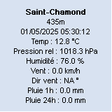
Les affichages de graphes se font sans problème ainsi que les mises à jour depuis HW.

Pour la latitude, c'est celle repérée sur Google Earth et oui, GW a des difficultés à prendre en compte la négativité. Je n'ai pas regardé pour modifier "ephemerides.xml" qui affiche des données farfelues telles que le lever du soleil à 13h24 :roll:

Le config.cfg du moment :
(j'ai enlevé les lignes "calibration")

[VERSION]
Version=2.0.312b
Licence=2iCFcMYKj3pCclpF5UxcTpUfzJZNnuNs4IMK
NewVersionAdvisory=0
[GENERAL]
MultipleInstances=0
Minimize=0
AutoUpdateTime=30
MsnDisplay=0
NewGUI=0
Confirm=1
Stylesheet=C:\Program Files\GraphWeather\Stylesheets\gauges.xml
StylesheetEditor=
Units=65536
UseConventionForWC=0
UseConventionForHI=0
DateLanguage=French
[PLUGIN_BASE]
Plugin=WS2300.dll
Source00=C:\HeavyWeather\history.dat
[PLUGIN_OPTIONAL1]
Plugin=
[PLUGIN_OPTIONAL2]
Plugin=
[LOCATION]
Longitude=57.660557
Latitude=-20.036112
Altitude=38.000000
Timezone=3
Country=Goodlands Île Maurice
Station=WS 2357
[DIRECTX]
DeviceType=1
MultiSampleType=0
MaxPoints=500
DXWidth=900
DXHeight=800
Interpolation=16416
[STATISTICS]
StatsAutoUpdate=1
StatsUpdateInterval=1
StatsGenerateXML=1
StatsGenerateNOAA=1
SolarRadiationThreshold=100
SunshineDayThreshold=75
[FTP]
Login=meneang_ftp41
Password=2GjWZ80Ijy5adApE
Server=ftp.free-h.org
ForceRestartOnError=0
DynamicConnection=0
ActiveMode=0
ExportsAtStartup=0
RealTimeAtStartup=0
[FTP_EXPORT_1]
Type=0
PluginType=0
Format=0
UpdateInterval=30
Range=30
RemoteFile=graph.jpg
Stylesheet=C:\Program Files\GraphWeather\Stylesheets\gauges.xml
Template=C:\Program Files\GraphWeather\Templates\
LocalDirectory=
RemoteDirectory=
[FTP_REALTIME_EXPORT]
Type=3
PluginType=0
Format=0
UpdateInterval=30
Range=60
RemoteFile=data.txt
Template=C:\Program Files\GraphWeather\Templates\realtime-default.txt
[HTTP]
AtStartup=0
Port=21
[AWEKAS]
Username=
Password=
Enabled=0
Language=en
[WUNDERGROUND]
Username=
Password=
Enabled=0
[PREVIMETEO]
Username=
Password=
Enabled=0
[ASMER]
FTP=
Active=0
Username=
Password=
Directory=
Enabled=0
[FORECAST]
sunny_comment=Ensoleillé
partly_cloudy_comment=Partiellement nuageux
cloudy_comment=Nuageux
heavy_cloudy_comment=Très nuageux
light_rain_comment=Pluie
heavy_rain_comment=Forte pluie
fog_comment=Brouillard
thunderstrom_comment=Orages
snow_comment=Neige
sleet_comment=Neige fondante
clear_night_comment=Nuit dégagée
partly_cloudy_night_comment=Partiellement nuageux
cloudy_night_comment=Nuageux
unknown_comment=Inconnu
SunnyLowPressure=1026.000000
HeavyCloudyHighPressure=1013.000000
HeavyCloudyLowPressure=1000.000000
HeavyRainHighPressure=973.000000
[WEATHER_CONDITIONS]
ValidityTime=10800

[POSITION]
Top=-32000
Left=-32000
Bottom=-31976
Right=-31840
[TAB_0]
Title=Graphique 1
Active=1
Stylesheet=C:\Program Files\GraphWeather\Stylesheets\gauges.xml
PaneOptionsVisible=1
AutoUpdateState=1
UpdateType=2
[STARTUP]
AutoUpdate=1

Pour les transferts vers mon site j'utilise FTP Expert qui peut s'automatiser pour les envois, je vais essayer de l'employer pour transmettre les données à partir de GW. Tu penses que ça peut fonctionner ?

Merci.
Station Vantage Pro 2
Site en reconstruction
Répondre